


Severe thunderstorms prompted tornado warnings and inundated downtown New Orleans on Wednesday morning, causing travel to be disrupted and forcing the closure of City Hall. The flooding occurred as a brewing tropical system, which may soon became Tropical Storm Barry, gathered strength over the Gulf of Mexico.
A flash flood emergency was declared in Jefferson Parish, with 4-6 inches of rain reported and more on the way as of 9:30 a.m. CDT.
New Orleans city officials and those with the National Weather Service urged residents to stay off the roads and to seek higher ground if they encountered flooding. An EarthCam posted in the French Quarter captured video of the city’s iconic Bourbon Street under water as heavy rain continued falling.
Between 6 a.m. and 9 a.m. local time, about 5.56 inches fell in downtown New Orleans. Webcam images showed cars navigating through deep floodwater on Bourbon Street as the torrent of water continued.
“Even though the most persistent heavy rain looks to be moving out of New Orleans for now, heavy downpours will still be a threat to move through at times over the coming days as the budding tropical system moves by just off of the coast to the south,” AccuWeather meteorologist Jake Sojda said.
The tropical threat brewing for late week and into the weekend has the potential to unleash a deluge of more than 2 feet of rain to parts of the Gulf states, which Sojda said posed a dangerous situation for the Louisiana coastline.
“This weekend looks to carry the most significant flooding threat for southern Louisiana, as what is expected to be Hurricane Barry by that time makes landfall in southwestern Louisiana,” Sojda said. He added, “Areas to the east of the landfall point are expected to see the heaviest rain this weekend, with 20-plus inches possible in spots. This threat includes New Orleans.”
The heavy rain on Wednesday and the approaching precipitation from the developing tropical system over the Gulf fueled flooding concerns in and around New Orleans.
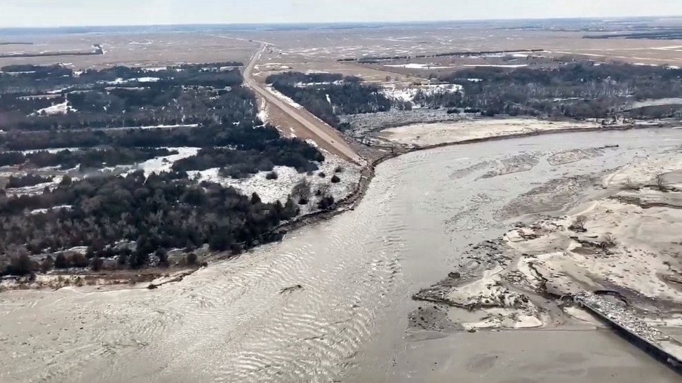
According to the New Orleans branch of the National Weather Service (NWS), the Mississippi River is expected to crest at 20 feet Friday night into Saturday. Levees in New Orleans are able to protect the city from surges up to 20 feet, creating the possibility for a disaster. The NWS said officials there are coordinating closely with the Army Corps of Engineers and the National Hurricane Center and urged residents in the area to be vigilant about monitoring for updates in the coming days about potential flooding.

The NWS Advanced Hydrologic Prediction Service shows the Mississippi River at New Orleans is expected to crest at 20 feet on Saturday, July 13. (NWS)
Despite the tornado warnings, there have not been any confirmed tornadoes in the area by late morning on Wednesday. However, people captured and posted to social media images of an apparent waterspout that formed over Lake Pontchartrain
New Orleans Mayor LaToya Cantrell said in a post on Twitter that police officers will ticket motorists who drive faster than 5 mph on streets with standing water and that parking restrictions on neutral grounds and sidewalks had been suspended.
“Residents are reminded not to block intersections or streetcar tracks. To reduce risk of street flooding, do not park in front of or on a catch basin,” Cantrell said.
The New Orleans Sewerage and Water Board said that all major pumps were operating and that officials had 118 out of an available 120.
More than 20,000 customers around New Orleans didn’t have power as of 10 a.m. local time, according to Entergy New Orleans.
Some departures out of Louis Armstrong New Orleans International Airport were delayed to the storms. The New Orleans Regional Transit Authority said all buses and streetcars were at a standstill.
“Once the streets are clear, they will continue their routes,” officials said.
Story cited here.


