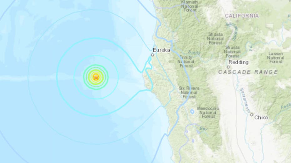
A 5.5 magnitude earthquake struck waters outside of Northern California on Sunday, according to the United States Geological Survey (USGS).
USGS said the earthquake was reported at around 11:45 a.m. on Sunday. It was detected 63 miles west of Petrolia and 74 miles southwest of Eureka.
The epicenter of the earthquake was in the Pacific Ocean. Officials say the depth of the earthquake was around 1.3 miles.
USGS’s ShakeMap recorded the earthquake’s epicenter at 6.8 on the Modified Mercalli Intensity Scale, but that intensity was not felt onshore – the USGS reported that the intensity in Petrolia was a 3.7.
CALIFORNIA EARTHQUAKES SHAKE, WAKE NEARBY RESIDENTS: REPORTS
The Modified Mercalli Intensity Scale, a scale that measures the intensity of earthquakes, considers anything between 6 and 7 as “strong.”
5.5 MAGNITUDE EARTHQUAKE SHAKES NORTHERN CALIFORNIA, FELT IN SACRAMENTO 160 MILES AWAY
Earthquakes with an intensity of 6 or more are noticed by nearly everyone and virtually guaranteed to cause some level of damage. Because the earthquake was far from land, the intensity did not register that highly on the coast.
There were no reports of injuries or damages immediately after the earthquake was reported.


